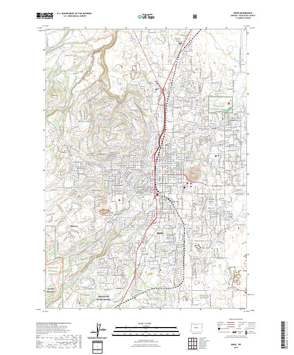
2024 Map of Bend
USGS Topo · Published 2024About this map
The Bend urban landscape is defined by the high desert's complex relationship with water and volcanic topography. The Deschutes River serves as the central spine of the area, bordered by the protected reaches of the Deschutes Wild and Scenic River to the south. The city's growth is framed by distinctive volcanic features like Pilot Butte, Awbrey Butte, and Overturf Butte, which shape the neighborhood layouts and street grids. The importance of historical irrigation is evident in the man-made waterways like the Bend Feed Canal, Swalley Canal, and Tumalo-Reed Canal that strike out across the landscape.
Find a feature on this map
32 named features on this map. Tap any name to fly to it.
Don’t see what you’re looking for? This feature index may not catch every label — zoom into the map to look around manually.
Map Details
Editions of this 2024 Bend Map
This is the sole edition of this map. No revisions or reprints were ever made.
Other maps of this area

1926 · Bend
USGS Topo · 1:125,000

1929 · Bend
USGS Topo · 1:125,000

1931 · Newberry Crater
USGS Topo · 1:125,000

1935 · Newberry Crater
USGS Topo · 1:125,000

1955 · Crescent
USGS Topo · 1:250,000

1955 · Bend
USGS Topo · 1:250,000

1957 · Crescent
USGS Topo · 1:250,000

1957 · Bend
USGS Topo · 1:250,000

1958 · Crescent
USGS Topo · 1:250,000

1958 · Bend
USGS Topo · 1:250,000