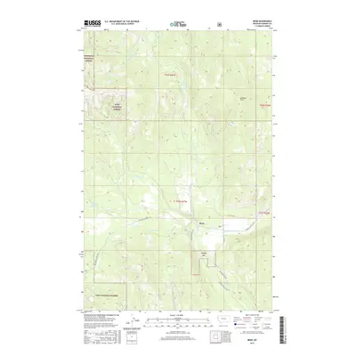
2017 Map of Bend
USGS Topo · Published 2017About this map
Bend serves as a central reference point in this corner of Sanders County, where the Thompson River winds through high-altitude timberlands. The geography is defined by its position at the boundary of two major preserves, the Kootenai National Forest and the Lolo National Forest. The map documents a complex network of forest development routes, including the Nat For Dev Rd Rd 7593, which provides access to the rugged interior. Notable water features like the Twin Lakes and Whitney Springs are vital markers for those navigating the creek systems of Lazier Cr and Boiling Springs Cr. High points such as Skookum Point overlook the transition from the river valley to the steep ridges, illustrating the era's continued focus on resource management and recreational access within Montana's protected wilderness.
Find a feature on this map
22 named features on this map. Tap any name to fly to it.
Don’t see what you’re looking for? This feature index may not catch every label — zoom into the map to look around manually.
Map Details
Editions of this 2017 Bend Map
This is the sole edition of this map. No revisions or reprints were ever made.
Other maps of this area

1920 · Jennings
USGS Topo · 1:125,000

1935 · Thompson Lakes
USGS Topo · 1:96,000

1937 · Thompson Falls
USGS Topo · 1:125,000

1942 · Thompson Lakes
USGS Topo · 1:125,000

1956 · Wallace
USGS Topo · 1:250,000

1957 · Kalispell
USGS Topo · 1:250,000

1960 · Kalispell
USGS Topo · 1:250,000

1960 · Wallace
USGS Topo · 1:250,000

1961 · Kalispell
USGS Topo · 1:250,000

1964 · Meadow Peak
USGS Topo · 1:24,000