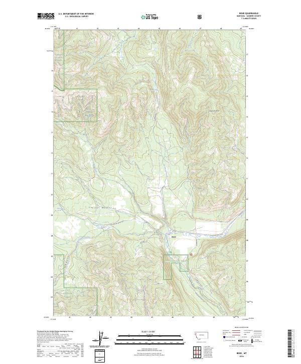
2024 Map of Bend
USGS Topo · Published 2024About this map
The small settlement of Bend sits at a crossroads where the Thompson River meets several forest access roads, providing a rare pocket of development in this heavily forested Montana landscape. The terrain is dominated by the steep rises of the Cabinet Mountains and prominent peaks like Skookum Point. Water is the primary architect of the geography here, with a complex network of drainages including Boiling Springs Creek, Lazier Creek, and Whitney Creek carving through the valleys. The land management is split between the Kootenai National Forest to the northwest and the Lolo National Forest which covers the majority of the map area. This data reflects a modern era of forest management where logging access via routes like the Thompson River Rd and ACM Rd defines the human footprint amidst the high-altitude lakes of Twin Lakes.
Find a feature on this map
25 named features on this map. Tap any name to fly to it.
Don’t see what you’re looking for? This feature index may not catch every label — zoom into the map to look around manually.
Map Details
Editions of this 2024 Bend Map
This is the sole edition of this map. No revisions or reprints were ever made.
Other maps of this area

1920 · Jennings
USGS Topo · 1:125,000

1935 · Thompson Lakes
USGS Topo · 1:96,000

1937 · Thompson Falls
USGS Topo · 1:125,000

1942 · Thompson Lakes
USGS Topo · 1:125,000

1956 · Wallace
USGS Topo · 1:250,000

1957 · Kalispell
USGS Topo · 1:250,000

1960 · Kalispell
USGS Topo · 1:250,000

1960 · Wallace
USGS Topo · 1:250,000

1961 · Kalispell
USGS Topo · 1:250,000

1964 · Meadow Peak
USGS Topo · 1:24,000