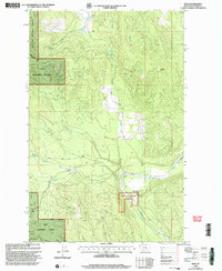
1999 Map of Bend
USGS Topo · Published 2003About this map
The Bend Historic Ranger Station serves as a focal point for this mountain landscape where the Lolo National Forest and Kootenai National Forest meet. This late-twentieth-century revision documents the administrative and natural geography of the Plains Ranger District, centered on the southward flow of the Thompson River. The map highlights a network of water sources essential to forest management and local history, including Boiling Springs, Whitney Springs, and the high-elevation Twin Lakes.
Find a feature on this map
14 named features on this map. Tap any name to fly to it.
Don’t see what you’re looking for? This feature index may not catch every label — zoom into the map to look around manually.
Map Details
Editions of this 1999 Bend Map
This is the sole edition of this map. No revisions or reprints were ever made.
Other maps of this area

1920 · Jennings
USGS Topo · 1:125,000

1935 · Thompson Lakes
USGS Topo · 1:96,000

1937 · Thompson Falls
USGS Topo · 1:125,000

1942 · Thompson Lakes
USGS Topo · 1:125,000

1956 · Wallace
USGS Topo · 1:250,000

1957 · Kalispell
USGS Topo · 1:250,000

1960 · Kalispell
USGS Topo · 1:250,000

1960 · Wallace
USGS Topo · 1:250,000

1961 · Kalispell
USGS Topo · 1:250,000

1964 · Meadow Peak
USGS Topo · 1:24,000