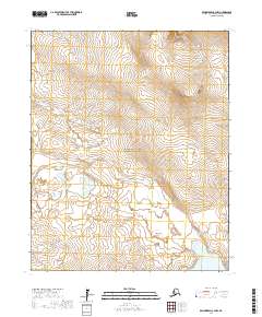
2017 Map of Bendeleben C-3 NW
USGS Topo · Published 2017About this map
The Seward Peninsula interior is defined by a landscape of high-latitude hydrology and dramatic relief within the Bering Land Bridge National Preserve. This 2017 survey reveals the intricate drainages of the Goodhope River and its tributaries, including Bilge Cr and Cottonwood Cr, as they navigate the varied topography of the Northwest Arctic. The southern portion of the map is dominated by the northern reaches of Imuruk Lake, the largest lake on the peninsula, which sits just south of the Continental Divide.
Find a feature on this map
14 named features on this map. Tap any name to fly to it.
Don’t see what you’re looking for? This feature index may not catch every label — zoom into the map to look around manually.
Map Details
Editions of this 2017 Bendeleben C-3 NW Map
This is the sole edition of this map. No revisions or reprints were ever made.
Other maps of this area

1950 · Bendeleben C-3
USGS Topo · 1:63,360

1950 · Bendeleben C-4
USGS Topo · 1:63,360

1950 · Bendeleben
USGS Topo · 1:250,000

1950 · Bendeleben D-3
USGS Topo · 1:63,360

1950 · Bendeleben D-4
USGS Topo · 1:63,360

1951 · Bendeleben
USGS Topo · 1:250,000

1964 · Bendeleben
USGS Topo · 1:250,000
2017 · Bendeleben D-3 SW
USGS Topo · 1:25,000
2017 · Bendeleben C-3 SW
USGS Topo · 1:25,000
2017 · Bendeleben D-3 SE
USGS Topo · 1:25,000