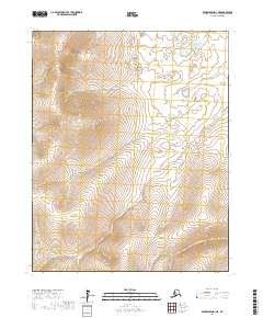
2017 Map of Bendeleben D-1 NE
USGS Topo · Published 2017About this map
Minnehaha Cr and Richmond Cr dominate this Arctic landscape, where the drainage patterns reveal a complex network of seasonal and permanent watercourses. This Northwest Arctic borough terrain is defined by the high elevations of the Bendeleben region, where water flows from the central heights toward the surrounding lowlands. The survey shows the distinct paths of Virginia Cr in the north and Limestone Cr in the south, illustrating how the natural topography dictates the movement of water across the tundra. Unlike maps of more settled regions, this sheet focuses on the raw hydrology of the area, providing a precise record of landmarks like Diamond Cr and Jump Cr that are essential for navigating this roadless environment.
Find a feature on this map
11 named features on this map. Tap any name to fly to it.
Don’t see what you’re looking for? This feature index may not catch every label — zoom into the map to look around manually.
Map Details
Editions of this 2017 Bendeleben D-1 NE Map
This is the sole edition of this map. No revisions or reprints were ever made.
Other maps of this area

1950 · Kotzebue A-1
USGS Topo · 1:63,360

1950 · Bendeleben
USGS Topo · 1:250,000

1950 · Bendeleben D-1
USGS Topo · 1:63,360

1951 · Candle
USGS Topo · 1:250,000

1951 · Selawik
USGS Topo · 1:250,000

1951 · Bendeleben
USGS Topo · 1:250,000

1951 · Kotzebue
USGS Topo · 1:250,000

1951 · Candle D-6
USGS Topo · 1:63,360

1951 · Selawik A-6
USGS Topo · 1:63,360

1955 · Candle
USGS Topo · 1:250,000