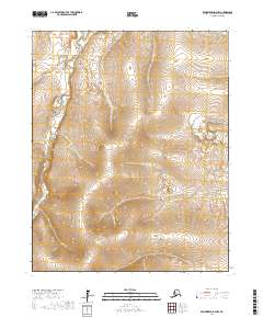
2017 Map of Bendeleben D-2 NW
USGS Topo · Published 2017About this map
The Inmachuk River carves a deep valley through this portion of the Northwest Arctic, serving as a primary corridor for travel and drainage. Modern transit is represented by Deering Road, which parallels the river's path, providing a terrestrial link through this Seward Peninsula landscape. The terrain is defined by a dense network of high-latitude tributaries, including Washington Cr and California Cr, which feed into the main river system. This 2017 survey shows the intricate relationship between the hydrologic system and the single improved road, illustrating the geographic constraints on movement in this part of Alaska. Small feeders such as Mystic Cr, Iona Cr, and Cue Cr indicate the significant drainage required by the surrounding highlands.
Find a feature on this map
15 named features on this map. Tap any name to fly to it.
Don’t see what you’re looking for? This feature index may not catch every label — zoom into the map to look around manually.
Map Details
Editions of this 2017 Bendeleben D-2 NW Map
This is the sole edition of this map. No revisions or reprints were ever made.
Other maps of this area

1950 · Bendeleben D-2
USGS Topo · 1:63,360

1950 · Bendeleben
USGS Topo · 1:250,000

1950 · Bendeleben D-3
USGS Topo · 1:63,360

1950 · Kotzebue A-3
USGS Topo · 1:63,360

1950 · Kotzebue A-2
USGS Topo · 1:63,360

1951 · Bendeleben
USGS Topo · 1:250,000

1951 · Kotzebue
USGS Topo · 1:250,000

1958 · Kotzebue
USGS Topo · 1:250,000

1964 · Bendeleben
USGS Topo · 1:250,000

1964 · Kotzebue
USGS Topo · 1:250,000