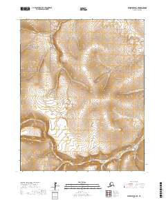
2017 Map of Bendeleben D-3 NE
USGS Topo · Published 2017About this map
The Seward Peninsula landscape is dominated here by the northwest corner of the Bering Land Bridge National Preserve, a protected area that preserves a vital piece of North American natural history. The terrain is characterized by a series of drainages that flow from the highlands toward the coast, including Sullivan Cr, Iron Cr, and Mystic Cr. The southern portion of the map shows the convergence of several waterways, where the Pinnell River meets the Inmachuk River near Logan Gulch.
Find a feature on this map
21 named features on this map. Tap any name to fly to it.
Don’t see what you’re looking for? This feature index may not catch every label — zoom into the map to look around manually.
Map Details
Editions of this 2017 Bendeleben D-3 NE Map
This is the sole edition of this map. No revisions or reprints were ever made.
Other maps of this area

1950 · Bendeleben D-2
USGS Topo · 1:63,360

1950 · Bendeleben
USGS Topo · 1:250,000

1950 · Bendeleben D-3
USGS Topo · 1:63,360

1950 · Kotzebue A-3
USGS Topo · 1:63,360

1950 · Kotzebue A-2
USGS Topo · 1:63,360

1951 · Bendeleben
USGS Topo · 1:250,000

1951 · Kotzebue
USGS Topo · 1:250,000

1958 · Kotzebue
USGS Topo · 1:250,000

1964 · Bendeleben
USGS Topo · 1:250,000

1964 · Kotzebue
USGS Topo · 1:250,000