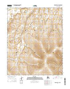
2014 Map of Bendeleben D-4 NW
USGS Topo · Published 2014About this map
The Bering Land Bridge National Preserve occupies much of this portion of the Seward Peninsula, protecting a landscape where ancient migration routes once linked continents. This 2014 survey illustrates a terrain defined by its drainage systems, where Eagle Cr and its tributaries carve through the western sections of the quadrangle. To the east, Pot Cr and Lava Cr flow through a region characterized by complex contour patterns, reflecting the area's volcanic history and periglacial features.
Find a feature on this map
10 named features on this map. Tap any name to fly to it.
Don’t see what you’re looking for? This feature index may not catch every label — zoom into the map to look around manually.
Map Details
Editions of this 2014 Bendeleben D-4 NW Map
This is the sole edition of this map. No revisions or reprints were ever made.
Other maps of this area

1950 · Bendeleben D-5
USGS Topo · 1:63,360

1950 · Bendeleben
USGS Topo · 1:250,000

1950 · Bendeleben D-4
USGS Topo · 1:63,360

1950 · Kotzebue A-4
USGS Topo · 1:63,360

1950 · Kotzebue A-5
USGS Topo · 1:63,360

1951 · Bendeleben
USGS Topo · 1:250,000

1951 · Kotzebue
USGS Topo · 1:250,000

1958 · Kotzebue
USGS Topo · 1:250,000

1964 · Bendeleben
USGS Topo · 1:250,000

1964 · Kotzebue
USGS Topo · 1:250,000