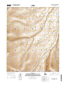
2014 Map of Bendeleben D-5 NW
USGS Topo · Published 2014About this map
The Bering Land Bridge National Preserve occupies the central and northern sections of this terrain, protecting a landscape that was once part of the massive land bridge connecting Asia and North America. This remote area on the Seward Peninsula is characterized by the winding headwaters of Humbolt Cr and Ballarat Cr, which drain the southern slopes of the interior highlands. These waterways are key features of the watershed within the northernmost reaches of the Seward Peninsula, illustrating the intricate drainage patterns of the Alaskan tundra before the streams merge into larger coastal systems. The lack of roads or established settlements on the map underscores the isolation and protected status of this arctic wilderness, where mapping is defined primarily by topography and natural watercourses.
Find a feature on this map
7 named features on this map. Tap any name to fly to it.
Don’t see what you’re looking for? This feature index may not catch every label — zoom into the map to look around manually.
Map Details
Editions of this 2014 Bendeleben D-5 NW Map
This is the sole edition of this map. No revisions or reprints were ever made.
Other maps of this area

1950 · Bendeleben D-6
USGS Topo · 1:63,360

1950 · Bendeleben D-5
USGS Topo · 1:63,360

1950 · Bendeleben
USGS Topo · 1:250,000

1950 · Kotzebue A-6
USGS Topo · 1:63,360

1950 · Kotzebue A-5
USGS Topo · 1:63,360

1951 · Bendeleben
USGS Topo · 1:250,000

1951 · Kotzebue
USGS Topo · 1:250,000

1958 · Kotzebue
USGS Topo · 1:250,000

1964 · Bendeleben
USGS Topo · 1:250,000

1964 · Kotzebue
USGS Topo · 1:250,000