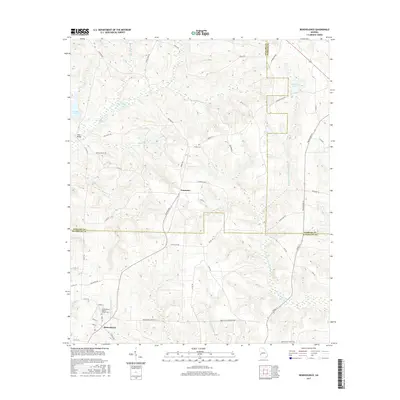
2017 Map of Benevolence
USGS Topo · Published 2017About this map
Benevolence Baptist Church Cem anchors the southwestern portion of this landscape, marking a central point of community and heritage where the borders of Stewart, Webster, and Randolph counties converge. The terrain is defined by a dense network of tributaries including Pataula Cr, W Fork Ichawaynochaway Cr, and Little Ichawaynochaway Cr, which create a complex system of ridges and valleys across the countryside. North of the small settlement at Troutman, the land rises toward the county lines, while landmarks like Singer Bridge across Singer Pond and Sardis Cem provide local reference points for genealogists and researchers. The abundance of named branches such as Watts Gin Br and Wards Mill Br hints at the former agrarian and industrial uses of these watercourses in this rural Georgia corridor.
Find a feature on this map
61 named features on this map. Tap any name to fly to it.
Don’t see what you’re looking for? This feature index may not catch every label — zoom into the map to look around manually.
Map Details
Editions of this 2017 Benevolence Map
This is the sole edition of this map. No revisions or reprints were ever made.
Other maps of this area

1950 · Lumpkin
USGS Topo · 1:24,000

1950 · Lumpkin
USGS Topo · 1:62,500

1953 · Dothan
USGS Topo · 1:250,000

1954 · Dothan
USGS Topo · 1:250,000

1955 · Dothan
USGS Topo · 1:250,000

1955 · Lumpkin
USGS Topo · 1:24,000

1955 · Lumpkin
USGS Topo · 1:62,500

1955 · Phenix City
USGS Topo · 1:250,000

1957 · Phenix City
USGS Topo · 1:250,000

1958 · Phenix City
USGS Topo · 1:250,000