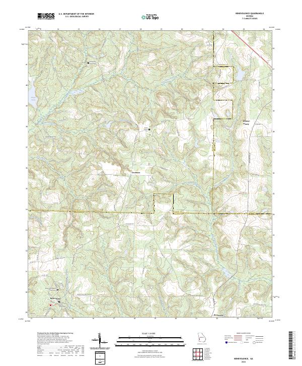
2024 Map of Benevolence
USGS Topo · Published 2024About this map
The unincorporated community of Benevolence sits at a crossroads in southern Stewart County, characterized by a landscape defined by the headwaters of the Little Ichawaynochaway Creek. This rural Georgia terrain is marked by family-named landmarks and historical congregations, such as the Benevolence Baptist Church and its accompanying Benevolence Baptist Church Cem. The map reveals a dispersed settlement pattern typical of the region's agricultural roots, with smaller nodes like Troutman and Brooksville connected by a network of county roads. To the north, the terrain transitions into the drainage basins of Pataula Creek and Watts Gin Branch, where the Sardis Church and Sardis Cem represent long-standing local landmarks. This survey provides a clear look at the intersection of three counties—Stewart, Webster, and Randolph—tracing the property lines and natural boundaries formed by water bodies like the West Fork Ichawaynochaway Creek.
Find a feature on this map
64 named features on this map. Tap any name to fly to it.
Don’t see what you’re looking for? This feature index may not catch every label — zoom into the map to look around manually.
Map Details
Editions of this 2024 Benevolence Map
This is the sole edition of this map. No revisions or reprints were ever made.
Other maps of this area

1950 · Lumpkin
USGS Topo · 1:24,000

1950 · Lumpkin
USGS Topo · 1:62,500

1953 · Dothan
USGS Topo · 1:250,000

1954 · Dothan
USGS Topo · 1:250,000

1955 · Dothan
USGS Topo · 1:250,000

1955 · Lumpkin
USGS Topo · 1:24,000

1955 · Lumpkin
USGS Topo · 1:62,500

1955 · Phenix City
USGS Topo · 1:250,000

1957 · Phenix City
USGS Topo · 1:250,000

1958 · Phenix City
USGS Topo · 1:250,000