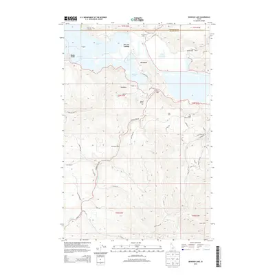
2013 Map of Benewah Lake
USGS Topo · Published 2013About this map
The Saint Joe River flows through a complex network of wetlands and lateral lakes in this northern Idaho survey, defining the lower reaches of its drainage before reaching the larger lake system to the west. This riverine landscape includes Benewah Lake, Chatcolet Lake, and the smaller Goose Heaven Lake, creating a mosaic of water and land that has historically supported seasonal landings and small settlements. Points of access like Silvertip Landing and the settlement at Ramsdell suggest a legacy of water-based transport and recreation along the river's slow-moving course.
Find a feature on this map
57 named features on this map. Tap any name to fly to it.
Don’t see what you’re looking for? This feature index may not catch every label — zoom into the map to look around manually.
Map Details
Editions of this 2013 Benewah Lake Map
This is the sole edition of this map. No revisions or reprints were ever made.
Other maps of this area

1955 · Spokane
USGS Topo · 1:250,000

1957 · St. Maries
USGS Topo · 1:62,500

1957 · Emida
USGS Topo · 1:62,500

1957 · Plummer
USGS Topo · 1:62,500

1957 · Tensed
USGS Topo · 1:62,500

1958 · Spokane
USGS Topo · 1:250,000

1975 · Plummer SE
USGS Topo · 1:24,000

1975 · Plummer NE
USGS Topo · 1:24,000

1981 · St Maries
USGS Topo · 1:100,000
1981 · Medimont
USGS Topo · 1:24,000