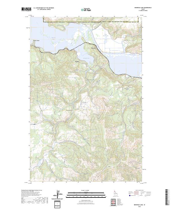
2024 Map of Benewah Lake
USGS Topo · Published 2024About this map
The Saint Joe Wild and Scenic River winds through a complex landscape of connected waterways and high elevations along the border of Kootenai and Benewah counties. This 2024 survey documents the hydrographic relationship between Chatcolet Lake, Benewah Lake, and Round Lake, which together form a significant wetland system punctuated by landmarks like Rocky Point and Goose Heaven Lake. The settlement pattern is largely defined by small communities such as Ramsdell and Parkline, alongside the tribal designated place of Hn'a'yqhn Bena.
Find a feature on this map
57 named features on this map. Tap any name to fly to it.
Don’t see what you’re looking for? This feature index may not catch every label — zoom into the map to look around manually.
Map Details
Editions of this 2024 Benewah Lake Map
This is the sole edition of this map. No revisions or reprints were ever made.
Other maps of this area

1955 · Spokane
USGS Topo · 1:250,000

1957 · St. Maries
USGS Topo · 1:62,500

1957 · Emida
USGS Topo · 1:62,500

1957 · Plummer
USGS Topo · 1:62,500

1957 · Tensed
USGS Topo · 1:62,500

1958 · Spokane
USGS Topo · 1:250,000

1975 · Plummer SE
USGS Topo · 1:24,000

1975 · Plummer NE
USGS Topo · 1:24,000

1981 · St Maries
USGS Topo · 1:100,000
1981 · Medimont
USGS Topo · 1:24,000