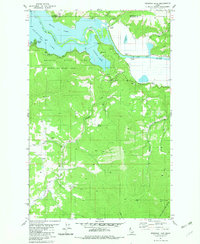
1981 Map of Benewah Lake
USGS Topo · Published 1982About this map
Benewah Lake and its intricate connection to the St Joe River dominate this early 1980s landscape, illustrating the water-rich geography of the Coeur d'Alene Indian Reservation. The map details the northern reaches of Heyburn State Park, where the river winds between Round Lake and Chatcolet Lake. Small riverside settlements like Silvertip Landing and Ramsdell are visible along the southern banks, while the terrain rises sharply to the south toward landmarks such as Negro Hill and Shay Hill. The distribution of Borrow Pits and a Gravel Pit near Hells Gulch suggests the ongoing maintenance of the St Maries River Road and local infrastructure. This survey captures a moment when the natural hydrology of the basin and the organized recreation of Idaho's first state park defined the region's character.
Find a feature on this map
28 named features on this map. Tap any name to fly to it.
Don’t see what you’re looking for? This feature index may not catch every label — zoom into the map to look around manually.
Map Details
Editions of this 1981 Benewah Lake Map
This is the sole edition of this map. No revisions or reprints were ever made.
Other maps of this area

1955 · Spokane
USGS Topo · 1:250,000

1957 · St. Maries
USGS Topo · 1:62,500

1957 · Emida
USGS Topo · 1:62,500

1957 · Plummer
USGS Topo · 1:62,500

1957 · Tensed
USGS Topo · 1:62,500

1958 · Spokane
USGS Topo · 1:250,000

1975 · Plummer SE
USGS Topo · 1:24,000

1975 · Plummer NE
USGS Topo · 1:24,000

1981 · St Maries
USGS Topo · 1:100,000
1981 · Medimont
USGS Topo · 1:24,000