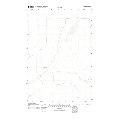
2011 Map of Benge
USGS Topo · Published 2011About this map
Benge and the small settlement of Lantz anchor this portion of the Channeled Scablands as it appeared in the early 21st century. The landscape is defined by the intersection of remote county routes, including N Benge Ritzville Rd and E Benge Winona Rd, which trace the path of commerce and travel through this dry volcanic terrain. The presence of the Clinesmith Ranch Airport highlights the importance of private aviation in managing the expansive ranching operations of Adams County. Scattered water sources such as Twelvemile Spring, Mud Spring, and the isolated Spider Lake stand out as critical landmarks in an otherwise arid environment, where road networks like Beckley Rd and Scott Rd connect distant homesteads and agricultural tracts.
Find a feature on this map
11 named features on this map. Tap any name to fly to it.
Don’t see what you’re looking for? This feature index may not catch every label — zoom into the map to look around manually.
Map Details
Editions of this 2011 Benge Map
This is the sole edition of this map. No revisions or reprints were ever made.
Other maps of this area

1950 · La Crosse
USGS Topo · 1:62,500

1950 · Benge
USGS Topo · 1:62,500

1952 · La Crosse
USGS Topo · 1:62,500

1952 · Benge
USGS Topo · 1:62,500

1953 · Walla Walla
USGS Topo · 1:250,000

1953 · Ritzville
USGS Topo · 1:250,000

1955 · Pullman
USGS Topo · 1:250,000

1955 · Spokane
USGS Topo · 1:250,000

1958 · Spokane
USGS Topo · 1:250,000

1958 · Pullman
USGS Topo · 1:250,000