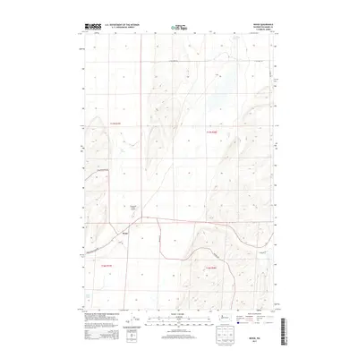
2013 Map of Benge
USGS Topo · Published 2013About this map
Benge serves as the central hub of this Adams County landscape, situated at the intersection of several key rural routes including S Benge Washtucna Rd and Scott Rd. The surrounding terrain is defined by its agricultural character and scattered water sources, such as Twelvemile Spring to the northeast and Mud Spring near the center of the township. Aviation infrastructure is represented by the Clinesmith Ranch Airport, which supports the ranching operations characteristic of the region. The map highlights the sprawling grid of the Public Land Survey System, with township lines for t17n r37e and t17n r38e clearly delineated. To the southwest, Spider Lake provides a notable hydrologic feature in an otherwise arid stretch of the state. This survey reflects the modern road network, including E Ralston Benge Rd, which connects the small settlement to the broader Palouse region.
Find a feature on this map
16 named features on this map. Tap any name to fly to it.
Don’t see what you’re looking for? This feature index may not catch every label — zoom into the map to look around manually.
Map Details
Editions of this 2013 Benge Map
This is the sole edition of this map. No revisions or reprints were ever made.
Other maps of this area

1950 · La Crosse
USGS Topo · 1:62,500

1950 · Benge
USGS Topo · 1:62,500

1952 · La Crosse
USGS Topo · 1:62,500

1952 · Benge
USGS Topo · 1:62,500

1953 · Walla Walla
USGS Topo · 1:250,000

1953 · Ritzville
USGS Topo · 1:250,000

1955 · Pullman
USGS Topo · 1:250,000

1955 · Spokane
USGS Topo · 1:250,000

1958 · Spokane
USGS Topo · 1:250,000

1958 · Pullman
USGS Topo · 1:250,000