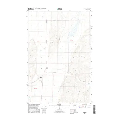
2017 Map of Benge
USGS Topo · Published 2017About this map
The small unincorporated community of Benge anchors this portion of Adams County, located at the junction of several regional thoroughfares including Benge-Washtucna Rd and Benge Winona Rd. The landscape is defined by the coulee-and-canyon topography of the Channeled Scablands, where water sources are often limited to isolated features like Twelvemile Spring in the northeast and Spider Lake in the southwest corner. The transition from the rugged basalt terrain to flatter plateau land is evidenced by the network of section-line roads and the presence of the Clinesmith Ranch Airport north of the town site.
Find a feature on this map
19 named features on this map. Tap any name to fly to it.
Don’t see what you’re looking for? This feature index may not catch every label — zoom into the map to look around manually.
Map Details
Editions of this 2017 Benge Map
This is the sole edition of this map. No revisions or reprints were ever made.
Other maps of this area

1950 · La Crosse
USGS Topo · 1:62,500

1950 · Benge
USGS Topo · 1:62,500

1952 · La Crosse
USGS Topo · 1:62,500

1952 · Benge
USGS Topo · 1:62,500

1953 · Walla Walla
USGS Topo · 1:250,000

1953 · Ritzville
USGS Topo · 1:250,000

1955 · Pullman
USGS Topo · 1:250,000

1955 · Spokane
USGS Topo · 1:250,000

1958 · Spokane
USGS Topo · 1:250,000

1958 · Pullman
USGS Topo · 1:250,000