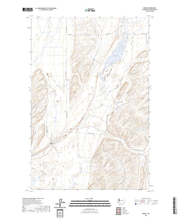
2023 Map of Benge
USGS Topo · Published 2023About this map
Benge serves as the focal point of this Eastern Washington landscape, where the intersection of Benge-Washtucna Rd, Ritzville-Benge Rd, and Benge-Winona Rd marks a historic nexus of regional travel. The topography is defined by the channeled scablands, with distinct coulees and depressions holding seasonal or permanent water bodies such as Twelvemile Lake and Spider Lake. A significant recreational and historical artery, the Columbia Plateau State Park Trail, cuts diagonally across the terrain, following a legacy rail corridor through the volcanic basalt formations. This network of backroads, including Twelve Mile Lake Rd and Zornes Rd, connects isolated water sources like Twelvemile Spring and Mud Spring, which remain vital landmarks in this arid, high-desert environment.
Find a feature on this map
20 named features on this map. Tap any name to fly to it.
Don’t see what you’re looking for? This feature index may not catch every label — zoom into the map to look around manually.
Map Details
Editions of this 2023 Benge Map
This is the sole edition of this map. No revisions or reprints were ever made.
Other maps of this area

1950 · La Crosse
USGS Topo · 1:62,500

1950 · Benge
USGS Topo · 1:62,500

1952 · La Crosse
USGS Topo · 1:62,500

1952 · Benge
USGS Topo · 1:62,500

1953 · Walla Walla
USGS Topo · 1:250,000

1953 · Ritzville
USGS Topo · 1:250,000

1955 · Pullman
USGS Topo · 1:250,000

1955 · Spokane
USGS Topo · 1:250,000

1958 · Spokane
USGS Topo · 1:250,000

1958 · Pullman
USGS Topo · 1:250,000