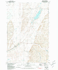
1981 Map of Benge
USGS Topo · Published 1981About this map
Benge serves as the central hub of this eastern Washington landscape, situated along the Burlington Northern railroad line. The settlement's connection to the regional transport network is further emphasized by the intersection of the Ritzville Benge Road and the Washtucna Burlington Road. The terrain is defined by a series of north-south coulees and ridges typical of the Channeled Scablands, where water remains a critical resource.
Find a feature on this map
25 named features on this map. Tap any name to fly to it.
Don’t see what you’re looking for? This feature index may not catch every label — zoom into the map to look around manually.
Map Details
Editions of this 1981 Benge Map
This is the sole edition of this map. No revisions or reprints were ever made.
Other maps of this area

1950 · La Crosse
USGS Topo · 1:62,500

1950 · Benge
USGS Topo · 1:62,500

1952 · La Crosse
USGS Topo · 1:62,500

1952 · Benge
USGS Topo · 1:62,500

1953 · Walla Walla
USGS Topo · 1:250,000

1953 · Ritzville
USGS Topo · 1:250,000

1955 · Pullman
USGS Topo · 1:250,000

1955 · Spokane
USGS Topo · 1:250,000

1958 · Spokane
USGS Topo · 1:250,000

1958 · Pullman
USGS Topo · 1:250,000