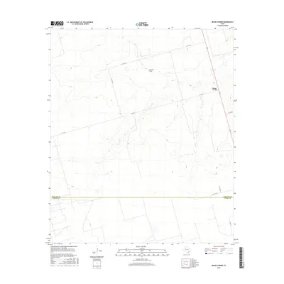
2016 Map of Benge Corner
USGS Topo · Published 2016About this map
Benge Corner serves as the primary orientation point in this high-plains landscape of the Permian Basin, situated just north of the Midland Co and Upton Co boundary. This area is characterized by the broad, episodic drainage of Johnson Draw, which cuts a north-south path through the center of the sheet. The map reveals a structured network of county roads and farm-to-market routes, such as W Fm 1787 and W Co Rd 270, that support the region's energy and ranching infrastructure. A survey of the terrain shows subtle topographic variations typical of this Texas territory, where the infrastructure of Wilson Ln and S Co RD 1210 reflects the persistent grid of local land use. The presence of numerous small pads and access roads illustrates the intensive resource management occurring in this rural sector south of Midland.
Find a feature on this map
10 named features on this map. Tap any name to fly to it.
Don’t see what you’re looking for? This feature index may not catch every label — zoom into the map to look around manually.
Map Details
Editions of this 2016 Benge Corner Map
This is the sole edition of this map. No revisions or reprints were ever made.
Other maps of this area

1954 · Pecos
USGS Topo · 1:250,000

1954 · San Angelo
USGS Topo · 1:250,000

1957 · Pecos
USGS Topo · 1:250,000

1958 · San Angelo
USGS Topo · 1:250,000

1964 · Bryant Ranch
USGS Topo · 1:24,000

1964 · Parks
USGS Topo · 1:24,000

1965 · San Angelo
USGS Topo · 1:250,000

1965 · Salt Lake
USGS Topo · 1:24,000

1968 · Benge Corner SE
USGS Topo · 1:24,000

1968 · Benge Corner NW
USGS Topo · 1:24,000