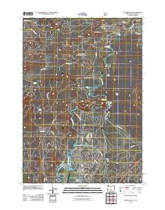
2011 Map of Benham Falls
USGS Topo · Published 2011About this map
The Deschutes River serves as the central artery of this Central Oregon landscape, weaving through a series of dramatic volcanic features and resort developments. The planned community of Sunriver is well-established in the southern portion of the sheet, featuring the Sunriver Post Office, Sunriver Airport, and extensive recreation sites like the Meadows Golf Course. North of the residential core, the river drops through several notable cascades including Benham Falls, Dillon Falls, and Lava Island Falls, which define the hydrological character of the Upper Deschutes.
Find a feature on this map
39 named features on this map. Tap any name to fly to it.
Don’t see what you’re looking for? This feature index may not catch every label — zoom into the map to look around manually.
Map Details
Editions of this 2011 Benham Falls Map
This is the sole edition of this map. No revisions or reprints were ever made.
Other maps of this area

1926 · Bend
USGS Topo · 1:125,000

1929 · Bend
USGS Topo · 1:125,000

1929 · Three Sisters
USGS Topo · 1:125,000

1930 · Maiden Peak
USGS Topo · 1:125,000

1931 · Newberry Crater
USGS Topo · 1:125,000

1932 · Three Sisters
USGS Topo · 1:125,000

1934 · Maiden Peak
USGS Topo · 1:125,000

1935 · Newberry Crater
USGS Topo · 1:125,000

1955 · Crescent
USGS Topo · 1:250,000

1955 · Bend
USGS Topo · 1:250,000