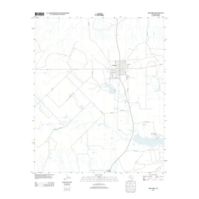
2013 Map of Benjamin
USGS Topo · Published 2013About this map
The town of Benjamin serves as the focal point for this Knox County survey, showing a structured grid of streets including Weatherly St, Core St, and Divide St. The landscape south of the settlement is defined by an extensive network of artificial water catchments and ranching infrastructure, punctuated by named features such as Quintana Tank, Jackson Tank, and Jamison Tank. These water sources, along with Lake Benjamin and the larger Lake Davis, are critical nodes in a region where seasonal drainage like Dutchman Cr and Gyp Cr carve through the plains.
Find a feature on this map
44 named features on this map. Tap any name to fly to it.
Don’t see what you’re looking for? This feature index may not catch every label — zoom into the map to look around manually.
Map Details
Editions of this 2013 Benjamin Map
This is the sole edition of this map. No revisions or reprints were ever made.
Other maps of this area

1954 · Wichita Falls
USGS Topo · 1:250,000

1958 · Wichita Falls
USGS Topo · 1:250,000

1966 · Truscott South
USGS Topo · 1:24,000

1966 · Gilliland
USGS Topo · 1:24,000

1966 · Maverick Flat
USGS Topo · 1:24,000

1967 · Cedar Mountain
USGS Topo · 1:24,000

1967 · Benjamin
USGS Topo · 1:24,000

1967 · Knox City NW
USGS Topo · 1:24,000

1967 · Rhineland
USGS Topo · 1:24,000

1968 · Munday West
USGS Topo · 1:24,000