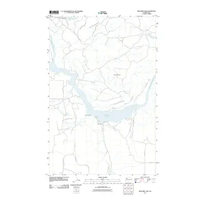
2011 Map of Benjamin Lake
USGS Topo · Published 2011About this map
The Spokane Indian Reservation defines the northern and central reaches of this landscape, where the waters of the Spokane River Arm branch through the terrain. In the northwest corner, industrial activity is visible at the Sherwood Mine and the associated Sherwood Project Tailings Dam, marking a localized area of resource extraction near the river's edge. The geography is characterized by deep ravines and high points, most notably Cayuse Mountain, which overlooks the canyon systems of Harker Canyon and Mill Canyon. Small water bodies such as Benjamin Lake and Carp Lake dot the plateaus and lower basins. A network of Bureau of Indian Affairs routes, including Bia Hwy 40 and Bia Hwy 38, provides the primary access through these tribal lands, connecting the high ridges to the shoreline developments near Breezy Bay Dr N.
Find a feature on this map
34 named features on this map. Tap any name to fly to it.
Don’t see what you’re looking for? This feature index may not catch every label — zoom into the map to look around manually.
Map Details
Editions of this 2011 Benjamin Lake Map
This is the sole edition of this map. No revisions or reprints were ever made.
Other maps of this area

1944 · Wellpinit
USGS Topo · 1:62,500

1945 · Reardan
USGS Topo · 1:62,500

1948 · Turtle Lake
USGS Topo · 1:62,500

1950 · Turtle Lake
USGS Topo · 1:62,500

1953 · Reardan
USGS Topo · 1:62,500

1953 · Wellpinit
USGS Topo · 1:62,500

1953 · Ritzville
USGS Topo · 1:250,000

1955 · Spokane
USGS Topo · 1:250,000

1958 · Spokane
USGS Topo · 1:250,000

1959 · Ritzville
USGS Topo · 1:250,000