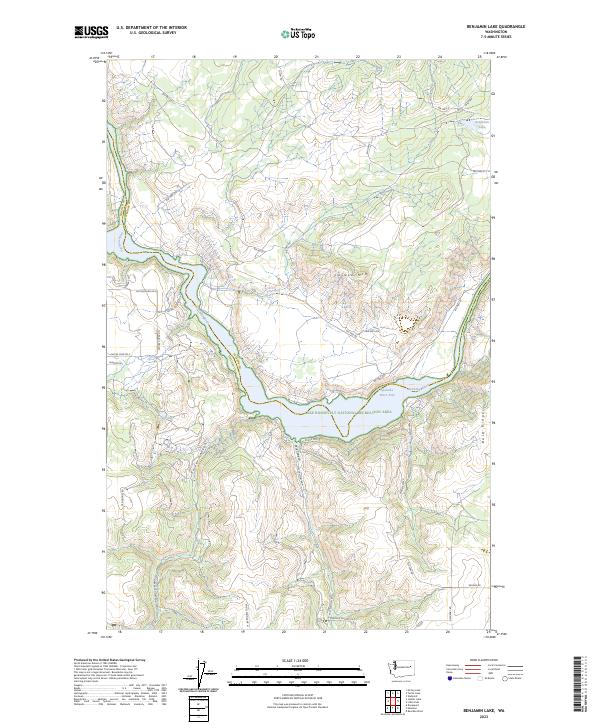
2023 Map of Benjamin Lake
USGS Topo · Published 2023About this map
The Spokane River winds through this northern Washington landscape, forming a sharp boundary between Lincoln and Stevens Counties. This 2023 edition highlights the extensive reaches of the Lake Roosevelt National Recreation Area, where the backed-up waters of the Spokane River Arm fill deep, branching valleys. The terrain is defined by dramatic elevation shifts, from the heights of Cayuse Mtn and Bald Ridge down to the secluded basins of Benjamin Lake and Carp Lake.
Find a feature on this map
40 named features on this map. Tap any name to fly to it.
Don’t see what you’re looking for? This feature index may not catch every label — zoom into the map to look around manually.
Map Details
Editions of this 2023 Benjamin Lake Map
This is the sole edition of this map. No revisions or reprints were ever made.
Other maps of this area

1944 · Wellpinit
USGS Topo · 1:62,500

1945 · Reardan
USGS Topo · 1:62,500

1948 · Turtle Lake
USGS Topo · 1:62,500

1950 · Turtle Lake
USGS Topo · 1:62,500

1953 · Reardan
USGS Topo · 1:62,500

1953 · Wellpinit
USGS Topo · 1:62,500

1953 · Ritzville
USGS Topo · 1:250,000

1955 · Spokane
USGS Topo · 1:250,000

1958 · Spokane
USGS Topo · 1:250,000

1959 · Ritzville
USGS Topo · 1:250,000