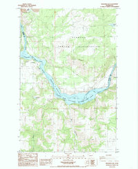
1985 Map of Benjamin Lake
USGS Topo · Published 1985About this map
Spokane Indian Reservation lands dominate the northern landscape of this mid-1980s survey, defined by the winding course of the Spokane River as it flows into the expansive Franklin D Roosevelt Lake. The terrain is marked by significant topographical variation, from the heights of Cayuse Mountain to the deep incisions of Mill Canyon and Harker Canyon in the south. This area serves as a critical intersection of natural resources and protected lands, evidenced by the industrial footprint of the Sherwood Mine near the northern boundary and the inclusion of the Coulee Dam National Recreation Area along the shoreline. Small water bodies like Benjamin Lake and Carp Lake dot the uplands, while the isolated settlement of Devore sits near the eastern margin. The map illustrates the 1980s balance between resource extraction, indigenous land management, and federal recreation zones along the Columbia River drainage.
Find a feature on this map
19 named features on this map. Tap any name to fly to it.
Don’t see what you’re looking for? This feature index may not catch every label — zoom into the map to look around manually.
Map Details
Editions of this 1985 Benjamin Lake Map
This is the sole edition of this map. No revisions or reprints were ever made.
Other maps of this area

1944 · Wellpinit
USGS Topo · 1:62,500

1945 · Reardan
USGS Topo · 1:62,500

1948 · Turtle Lake
USGS Topo · 1:62,500

1950 · Turtle Lake
USGS Topo · 1:62,500

1953 · Reardan
USGS Topo · 1:62,500

1953 · Wellpinit
USGS Topo · 1:62,500

1953 · Ritzville
USGS Topo · 1:250,000

1955 · Spokane
USGS Topo · 1:250,000

1958 · Spokane
USGS Topo · 1:250,000

1959 · Ritzville
USGS Topo · 1:250,000