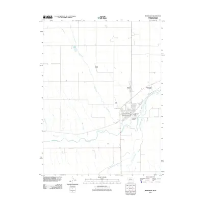
2011 Map of Benkelman
USGS Topo · Published 2011About this map
The confluence of the Republican River and the South Fork Republican River defines the landscape surrounding Benkelman, the seat of Dundy County. This 2011 survey illustrates a community deeply integrated with its river valleys and agricultural surroundings. Local infrastructure is well-represented, from the Benkelman Post Office and the Dundy County Fairgrounds to specialized facilities like the Benkelman State Fish Hatchery. The presence of Hoppys Airport and Jones Airport suggests a reliance on regional aviation in this southwestern corner of Nebraska.
Find a feature on this map
19 named features on this map. Tap any name to fly to it.
Don’t see what you’re looking for? This feature index may not catch every label — zoom into the map to look around manually.
Map Details
Editions of this 2011 Benkelman Map
This is the sole edition of this map. No revisions or reprints were ever made.
Other maps of this area

1950 · Mc Donald
USGS Topo · 1:62,500

1951 · Bird City North
USGS Topo · 1:62,500

1951 · Mc Donald
USGS Topo · 1:62,500

1954 · McCook
USGS Topo · 1:250,000

1954 · Goodland
USGS Topo · 1:250,000

1956 · Goodland
USGS Topo · 1:250,000

1957 · McCook
USGS Topo · 1:250,000

1957 · Goodland
USGS Topo · 1:250,000

1958 · McCook
USGS Topo · 1:250,000
1961 · Parks
USGS Topo · 1:24,000
Featured Places
- Benkelman, NE
- Rainbow Fountain Park, Benkelman
- Baney Trailer Park, Benkelman
- Merklin Trailer Court, Benkelman
- Cheyenne County, KS