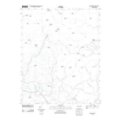
2010 Map of Benn Knob
USGS Topo · Published 2010About this map
The South Mountains define the topography of this region, creating a complex network of ridges and watercourses within the Benn Knob quadrangle. The northern reaches are dominated by high points like Hickorynut Mountain and Rainbow Mountain, while the Morganton Watershed Dam regulates the local flow near the headwaters of He Creek. Local transport follows the winding terrain, with routes like Moriah School Rd and Golden Valley Rd connecting small clearings and rural homesteads.
Find a feature on this map
74 named features on this map. Tap any name to fly to it.
Don’t see what you’re looking for? This feature index may not catch every label — zoom into the map to look around manually.
Map Details
Editions of this 2010 Benn Knob Map
This is the sole edition of this map. No revisions or reprints were ever made.
Other maps of this area

1905 · Morganton
USGS Topo · 1:125,000

1950 · Shelby
USGS Topo · 1:62,500

1953 · Charlotte
USGS Topo · 1:250,000

1954 · Charlotte
USGS Topo · 1:250,000

1956 · Valdese
USGS Topo · 1:24,000

1956 · Benn Knob
USGS Topo · 1:24,000

1956 · Casar
USGS Topo · 1:24,000

1956 · Morganton South
USGS Topo · 1:24,000

1960 · Charlotte
USGS Topo · 1:250,000

1962 · Charlotte
USGS Topo · 1:250,000