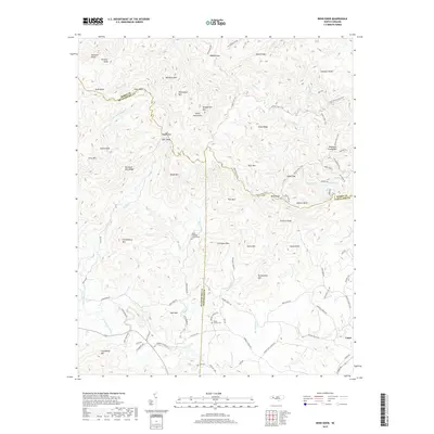
2019 Map of Benn Knob
USGS Topo · Published 2019About this map
Benn Knob and the surrounding peaks of the South Mountains dominate this 2019 survey, where the borders of Burke, Rutherford, and Cleveland counties converge. The terrain is defined by a series of steep ridges and knobs, including Hickorynut Mtn and Bumgarther Mtn, which separate the headwaters of the First Broad River from the north-flowing Jacob Fork. While much of the northern landscape is accessible only by paths like the Lower CCC Trail or Raven Rock Trail, the southern portion near the settlement of Casar shows more established road networks. For those tracing local heritage, the map identifies significant landmarks such as the Mount Pleasant Church Cem and Mount Moriah Cem, along with former civic sites like the Moriah School Rd. The drainage patterns, from Shinny Cr to No Business Cr, reveal a landscape shaped by narrow hollows and high gaps like Woods Gap and Walnut Gap.
Find a feature on this map
98 named features on this map. Tap any name to fly to it.
Don’t see what you’re looking for? This feature index may not catch every label — zoom into the map to look around manually.
Map Details
Editions of this 2019 Benn Knob Map
This is the sole edition of this map. No revisions or reprints were ever made.
Other maps of this area

1905 · Morganton
USGS Topo · 1:125,000

1950 · Shelby
USGS Topo · 1:62,500

1953 · Charlotte
USGS Topo · 1:250,000

1954 · Charlotte
USGS Topo · 1:250,000

1956 · Valdese
USGS Topo · 1:24,000

1956 · Benn Knob
USGS Topo · 1:24,000

1956 · Casar
USGS Topo · 1:24,000

1956 · Morganton South
USGS Topo · 1:24,000

1960 · Charlotte
USGS Topo · 1:250,000

1962 · Charlotte
USGS Topo · 1:250,000