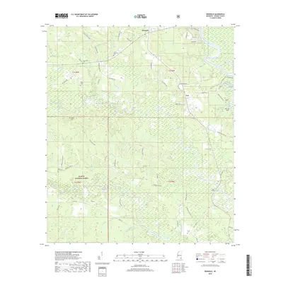
2018 Map of Benndale
USGS Topo · Published 2018About this map
De Soto National Forest lands cover much of this George County landscape, where the Pascagoula River and Black Creek define the local geography. The settlement of Benndale sits at the northern edge, serving as a hub for a network of rural roads such as Vardaman Graves Rd and Buddy Fairley Loop. This area is particularly rich in family burial grounds and small community landmarks, reflecting a deep-rooted genealogical history.
Find a feature on this map
77 named features on this map. Tap any name to fly to it.
Don’t see what you’re looking for? This feature index may not catch every label — zoom into the map to look around manually.
Map Details
Editions of this 2018 Benndale Map
This is the sole edition of this map. No revisions or reprints were ever made.
Other maps of this area

1941 · Vancleave
USGS Topo · 1:62,500

1941 · Lucedale
USGS Topo · 1:62,500

1943 · Lucedale
USGS Topo · 1:62,500

1943 · Vancleave
USGS Topo · 1:62,500

1944 · Vancleave
USGS Topo · 1:62,500

1947 · Benndale
USGS Topo · 1:62,500

1949 · Benndale
USGS Topo · 1:62,500

1953 · Mobile
USGS Topo · 1:250,000

1954 · Vestry
USGS Topo · 1:62,500

1957 · Mobile
USGS Topo · 1:250,000