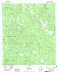
1982 Map of Benndale
USGS Topo · Published 1982About this map
Pascagoula River and its intricate network of tributaries define this part of George County, where the University of Mississippi Forest covers much of the southwestern landscape. The area is characterized by low-lying wetlands and winding waterways like Black Creek and Red Creek, which carve through the Wyatt Hills. Smaller settlements such as Benndale and Dale are connected by rural roads, while an Old RR Grade serves as a physical reminder of former industrial transport through these pine-heavy corridors.
Find a feature on this map
41 named features on this map. Tap any name to fly to it.
Don’t see what you’re looking for? This feature index may not catch every label — zoom into the map to look around manually.
Map Details
Editions of this 1982 Benndale Map
This is the sole edition of this map. No revisions or reprints were ever made.
Other maps of this area

1941 · Vancleave
USGS Topo · 1:62,500

1941 · Lucedale
USGS Topo · 1:62,500

1943 · Lucedale
USGS Topo · 1:62,500

1943 · Vancleave
USGS Topo · 1:62,500

1944 · Vancleave
USGS Topo · 1:62,500

1947 · Benndale
USGS Topo · 1:62,500

1949 · Benndale
USGS Topo · 1:62,500

1953 · Mobile
USGS Topo · 1:250,000

1954 · Vestry
USGS Topo · 1:62,500

1957 · Mobile
USGS Topo · 1:250,000