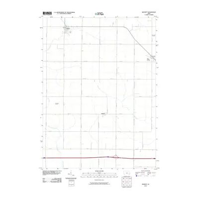
2010 Map of Bennett
USGS Topo · Published 2010About this map
Bennett sits at the northern edge of this Cedar County landscape, serving as a focal point for the surrounding agricultural grid. The terrain is defined by the winding paths of several waterways, including Bennett Creek, Otter Creek, and Little Elkhorn Creek, which cut through the strictly organized township roads. To the east, New Liberty rests near the Cedar Scott Co Line, while the smaller settlement of Sunbury occupies a central position. These communities are linked by a network of named avenues and numbered streets that reflect the region's enduring rural structure. For those tracing local heritage, the map identifies specific landmarks like the Farmington Cemetery and New Liberty Cemetery, alongside civic hubs such as the Bennett Post Office and New Liberty Post Office. The drainage patterns of Mud Creek further illustrate the natural topography that shaped early settlement and farm placement in this part of eastern Iowa.
Find a feature on this map
30 named features on this map. Tap any name to fly to it.
Don’t see what you’re looking for? This feature index may not catch every label — zoom into the map to look around manually.
Map Details
Editions of this 2010 Bennett Map
This is the sole edition of this map. No revisions or reprints were ever made.
Other maps of this area

1889 · Tipton
USGS Topo · 1:62,500

1890 · Durant
USGS Topo · 1:62,500

1890 · Tipton
USGS Topo · 1:62,500

1891 · Wilton Junction
USGS Topo · 1:62,500

1892 · Wheatland
USGS Topo · 1:62,500

1894 · Wheatland
USGS Topo · 1:62,500

1894 · Durant
USGS Topo · 1:62,500

1901 · Rock Island
USGS Topo · 1:125,000

1901 · Stanwood
USGS Topo · 1:125,000

1910 · Rock Island
USGS Topo · 1:125,000