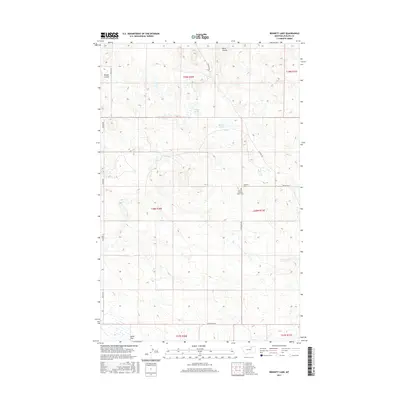
2017 Map of Bennett Lake
USGS Topo · Published 2017About this map
Scandia Lutheran Church Cem stands as a primary cultural landmark in this section of Phillips County, reflecting the early Scandinavian settlement patterns that shaped the northern plains. The landscape is defined by its drainage and seasonal water features, including the central Bennett Lake and the nearby Solberg Slough. This high-plains terrain is etched by several watercourses such as Black Coulee, Brown Coulee, and Alkali Cr, which flows toward the expansive Alkali Flat in the southwest. A sparse but essential road network, including Sun Prairie Rd and Content Rd, connects these remote reaches, tracing the section lines of the Public Land Survey System through townships like t28n r31e. The presence of D H S Cr and Swedes Sq W further underscores the local history and naming conventions of the ranching and farming community.
Find a feature on this map
19 named features on this map. Tap any name to fly to it.
Don’t see what you’re looking for? This feature index may not catch every label — zoom into the map to look around manually.
Map Details
Editions of this 2017 Bennett Lake Map
This is the sole edition of this map. No revisions or reprints were ever made.
Other maps of this area

1905 · Bowdoin
USGS Topo · 1:62,500

1954 · Glasgow
USGS Topo · 1:250,000

1957 · Glasgow
USGS Topo · 1:250,000

1958 · Glasgow
USGS Topo · 1:250,000

1968 · Malta West
USGS Topo · 1:24,000

1968 · Malta East
USGS Topo · 1:24,000

1984 · Clanton Coulee
USGS Topo · 1:24,000
1984 · Horse Pasture Coulee
USGS Topo · 1:24,000
1984 · Mitchell Corner
USGS Topo · 1:24,000
1984 · Bennett Lake NW
USGS Topo · 1:24,000