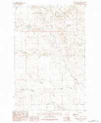
1984 Map of Bennett Lake NW
USGS Topo · Published 1984About this map
Alkali Creek defines the drainage pattern of this high plains landscape in Phillips County, winding southward through a network of dry coulees. Based on field checks conducted in 1978, this survey captures the rural character of northern Montana where water sources dictate the placement of local landmarks. The terrain is deeply etched by ephemeral waterways like Brown Coulee and Halfway Coulee, reflecting a ranching and grazing economy dependent on seasonal runoff. To the south, Rudolph Coulee and Williams Coulee intersect the creek, illustrating the natural land divisions that historically influenced property lines and grazing rights across the township boundaries of T 29 N and T 28 N.
Find a feature on this map
7 named features on this map. Tap any name to fly to it.
Don’t see what you’re looking for? This feature index may not catch every label — zoom into the map to look around manually.
Map Details
Editions of this 1984 Bennett Lake NW Map
This is the sole edition of this map. No revisions or reprints were ever made.
Other maps of this area

1953 · Havre
USGS Topo · 1:250,000

1954 · Glasgow
USGS Topo · 1:250,000

1957 · Glasgow
USGS Topo · 1:250,000

1957 · Havre
USGS Topo · 1:250,000

1958 · Glasgow
USGS Topo · 1:250,000

1958 · Havre
USGS Topo · 1:250,000

1965 · Wagner
USGS Topo · 1:24,000

1965 · West Alkali Reservoir
USGS Topo · 1:24,000
1965 · Seymour Reservoir
USGS Topo · 1:24,000

1968 · Malta West
USGS Topo · 1:24,000