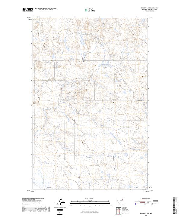
2024 Map of Bennett Lake
USGS Topo · Published 2024About this map
Scandia Lutheran Church Cem stands as a central historical landmark in this Phillips County landscape, situated near the intersection of Sun Prairie Rd and Content Rd. The terrain is defined by a series of drainages and seasonal water features, including the eponymous Bennett Lake and the winding course of D H S Creek. To the southwest, the environment shifts toward the Alkali Flat, where Alkali Creek meanders through the lower elevations. The map reveals a sparse network of section roads like Regina Rd and Swedes Sq W, which follow the rigid grid of the Public Land Survey System. This layout reflects the enduring ranching and agricultural patterns of the Montana plains, where community life often centered around isolated country churches and cemeteries like Scandia Lutheran.
Find a feature on this map
16 named features on this map. Tap any name to fly to it.
Don’t see what you’re looking for? This feature index may not catch every label — zoom into the map to look around manually.
Map Details
Editions of this 2024 Bennett Lake Map
This is the sole edition of this map. No revisions or reprints were ever made.
Other maps of this area

1905 · Bowdoin
USGS Topo · 1:62,500

1954 · Glasgow
USGS Topo · 1:250,000

1957 · Glasgow
USGS Topo · 1:250,000

1958 · Glasgow
USGS Topo · 1:250,000

1968 · Malta West
USGS Topo · 1:24,000

1968 · Malta East
USGS Topo · 1:24,000

1984 · Clanton Coulee
USGS Topo · 1:24,000
1984 · Horse Pasture Coulee
USGS Topo · 1:24,000
1984 · Mitchell Corner
USGS Topo · 1:24,000
1984 · Bennett Lake NW
USGS Topo · 1:24,000