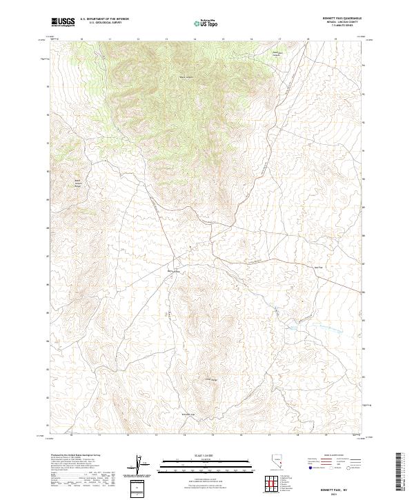
2021 Map of Bennett Pass
USGS Topo · Published 2021About this map
Bennett Pass serves as a critical geographic transition in this high-desert portion of Lincoln County, situated between the Black Canyon Range to the north and the Chief Range to the south. The landscape is defined by its drainage patterns and seasonal water access, with the Bennett Springs Wash and the local Bennett Springs providing the primary landmarks in an otherwise arid expanse.
Find a feature on this map
17 named features on this map. Tap any name to fly to it.
Don’t see what you’re looking for? This feature index may not catch every label — zoom into the map to look around manually.
Map Details
Editions of this 2021 Bennett Pass Map
This is the sole edition of this map. No revisions or reprints were ever made.
Other maps of this area

1885 · Pioche
USGS Topo · 1:250,000

1886 · Pioche
USGS Topo · 1:250,000

1916 · Highland
USGS Topo · 1:62,500

1918 · Highland
USGS Topo · 1:62,500

1921 · NW 1/4 Panaca
USGS Topo · 1:48,000

1953 · Highland Peak
USGS Topo · 1:24,000

1953 · Pioche
USGS Topo · 1:24,000

1954 · Caliente
USGS Topo · 1:250,000

1959 · Caliente
USGS Topo · 1:250,000
1970 · The Bluffs
USGS Topo · 1:24,000