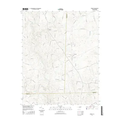
2016 Map of Bennett
USGS Topo · Published 2016About this map
Deep River carves a winding path through this central North Carolina landscape, where the rural communities of Bennett and Cheeks serve as local hubs. The terrain is defined by a dense network of tributaries including Richland Creek, Brush Creek, and Fork Creek, which once powered the agricultural and milling economy of the region. This economic history is preserved in the road names themselves, such as Lambeth Mill Rd and Lane Mill Rd, suggesting the historical importance of water-driven industry.
Find a feature on this map
90 named features on this map. Tap any name to fly to it.
Don’t see what you’re looking for? This feature index may not catch every label — zoom into the map to look around manually.
Map Details
Editions of this 2016 Bennett Map
This is the sole edition of this map. No revisions or reprints were ever made.
Other maps of this area

1942 · Troy
USGS Topo · 1:125,000

1953 · Raleigh
USGS Topo · 1:250,000

1954 · Raleigh
USGS Topo · 1:250,000

1968 · Ramseur
USGS Topo · 1:24,000

1968 · Coleridge
USGS Topo · 1:24,000

1968 · Erect
USGS Topo · 1:24,000

1968 · Bennett
USGS Topo · 1:24,000

1969 · Siler City
USGS Topo · 1:24,000

1970 · Bear Creek
USGS Topo · 1:24,000

1974 · Putnam
USGS Topo · 1:24,000