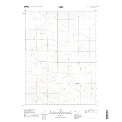
2017 Map of Bennett Reservoir East
USGS Topo · Published 2017About this map
Lodgepole Cr flows through the southern portion of this Kimball County landscape, representing a critical water source in the high plains of western Nebraska. The terrain is defined by a structured network of section lines and county roads, such as Co Rd 44 and Co Rd 49, which facilitate movement across the agricultural and ranching parcels of Townships 15 and 16 North. Historically significant water management is evident in the presence of the Bennett Canal, a feature indicating the region's reliance on irrigation to support its arid environment. The map captures the intersection of natural drainage and human engineering, where the gentle undulations of the prairie are bisected by an orderly grid of local routes like Co Rd 52 and Co Rd 46.
Find a feature on this map
15 named features on this map. Tap any name to fly to it.
Don’t see what you’re looking for? This feature index may not catch every label — zoom into the map to look around manually.
Map Details
Editions of this 2017 Bennett Reservoir East Map
This is the sole edition of this map. No revisions or reprints were ever made.
Other maps of this area

1954 · Scottsbluff
USGS Topo · 1:250,000

1958 · Scottsbluff
USGS Topo · 1:250,000

1972 · Dix
USGS Topo · 1:24,000

1972 · Owasco
USGS Topo · 1:24,000

1972 · Kimball
USGS Topo · 1:24,000

1973 · Potter 2 SW
USGS Topo · 1:24,000

1973 · Kimball 1 SE
USGS Topo · 1:24,000

1973 · Kimball 1 NE
USGS Topo · 1:24,000

1973 · Kimball 1 NW
USGS Topo · 1:24,000
1973 · Kimball 1 SW
USGS Topo · 1:24,000