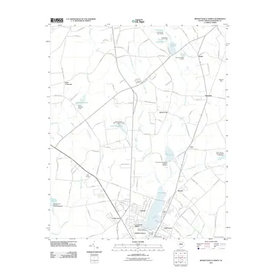
2011 Map of Bennettsville North
USGS Topo · Published 2011About this map
Bennettsville and its northern outskirts are defined by an intricate network of creeks and named millponds that speak to the agricultural and water-powered industrial history of Marlboro County. The landscape is dotted with several family and community burial grounds, including Hubbard Cemetery and Level Green Cemetery, which serve as vital landmarks for local genealogical research. In the lower half of the sheet, the expansive Lake Wallace acts as a central geographic feature, surrounded by growing residential areas like Country Club Heights and Lake Terrace.
Find a feature on this map
127 named features on this map. Tap any name to fly to it.
Don’t see what you’re looking for? This feature index may not catch every label — zoom into the map to look around manually.
Map Details
Editions of this 2011 Bennettsville North Map
This is the sole edition of this map. No revisions or reprints were ever made.
Other maps of this area

1942 · Rockingham
USGS Topo · 1:125,000

1949 · Gibson
USGS Topo · 1:24,000

1949 · Ghio
USGS Topo · 1:24,000

1949 · Hamlet
USGS Topo · 1:62,500

1953 · Florence
USGS Topo · 1:250,000

1954 · Florence
USGS Topo · 1:250,000
1971 · Diggs
USGS Topo · 1:24,000
1971 · Wallace
USGS Topo · 1:24,000

1971 · Society Hill
USGS Topo · 1:24,000

1972 · Clio
USGS Topo · 1:24,000