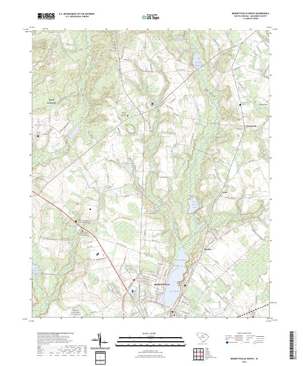
2024 Map of Bennettsville North
USGS Topo · Published 2024About this map
Lake Wallace and the northern outskirts of Bennettsville dominate the southern portion of this landscape, transitioning into a region defined by agricultural history and ancestral sites. The area is exceptionally dense with genealogical landmarks, featuring numerous historic burial grounds such as New Hill Church Graveyard, Bethel United Methodist Church Graveyard, and Newton Cem Number 1. These sites, alongside family-named markers like Chavis Cem, indicate a deeply rooted community structure dating back generations in Marlboro County.
Find a feature on this map
104 named features on this map. Tap any name to fly to it.
Don’t see what you’re looking for? This feature index may not catch every label — zoom into the map to look around manually.
Map Details
Editions of this 2024 Bennettsville North Map
This is the sole edition of this map. No revisions or reprints were ever made.
Other maps of this area

1942 · Rockingham
USGS Topo · 1:125,000

1949 · Gibson
USGS Topo · 1:24,000

1949 · Ghio
USGS Topo · 1:24,000

1949 · Hamlet
USGS Topo · 1:62,500

1953 · Florence
USGS Topo · 1:250,000

1954 · Florence
USGS Topo · 1:250,000
1971 · Diggs
USGS Topo · 1:24,000
1971 · Wallace
USGS Topo · 1:24,000

1971 · Society Hill
USGS Topo · 1:24,000

1972 · Clio
USGS Topo · 1:24,000