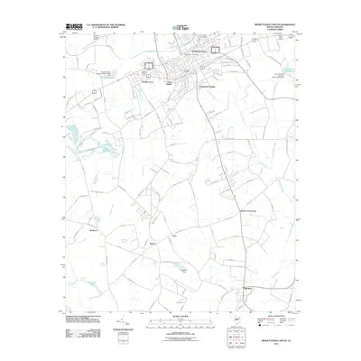
2011 Map of Bennettsville South
USGS Topo · Published 2011About this map
Bennettsville serves as the focal point of this 2011 survey, showing the residential expansion of neighborhoods like Dundee Acres, Grace Heights, and Sunnybrook Heights south of the city center. The landscape is defined by its complex drainage systems, including Crooked Creek and Muddy Creek, which feed into local landmarks like McCalls Millpond and Covington Millpond. These water bodies are often constrained by structures such as the Noname 35013 D-3453 Dam.
Find a feature on this map
119 named features on this map. Tap any name to fly to it.
Don’t see what you’re looking for? This feature index may not catch every label — zoom into the map to look around manually.
Map Details
Editions of this 2011 Bennettsville South Map
This is the sole edition of this map. No revisions or reprints were ever made.
Other maps of this area

1942 · Rockingham
USGS Topo · 1:125,000

1943 · Gum Swamp
USGS Topo · 1:62,500

1953 · Florence
USGS Topo · 1:250,000

1954 · Florence
USGS Topo · 1:250,000

1963 · Mont Clare
USGS Topo · 1:24,000
1971 · Wallace
USGS Topo · 1:24,000

1971 · Society Hill
USGS Topo · 1:24,000

1972 · Drake
USGS Topo · 1:24,000

1972 · Clio
USGS Topo · 1:24,000
1972 · Bennettsville North
USGS Topo · 1:24,000