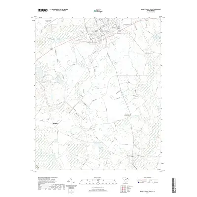
2020 Map of Bennettsville South
USGS Topo · Published 2020About this map
Bennettsville serves as the focal point of this region, where a dense grid of streets like Railroad Ave and E Market St gives way to the agricultural landscape of Marlboro County. The terrain is defined by a network of slow-moving water and wetlands, including Crooked Creek to the north and the sprawling Muddy Creek to the south. Small rural communities such as Scott, Blenheim, and Monroe Crossroads are connected by a web of county roads, reflecting the traditional settlement patterns of the South Carolina coastal plain.
Find a feature on this map
112 named features on this map. Tap any name to fly to it.
Don’t see what you’re looking for? This feature index may not catch every label — zoom into the map to look around manually.
Map Details
Editions of this 2020 Bennettsville South Map
This is the sole edition of this map. No revisions or reprints were ever made.
Other maps of this area

1942 · Rockingham
USGS Topo · 1:125,000

1943 · Gum Swamp
USGS Topo · 1:62,500

1953 · Florence
USGS Topo · 1:250,000

1954 · Florence
USGS Topo · 1:250,000

1963 · Mont Clare
USGS Topo · 1:24,000
1971 · Wallace
USGS Topo · 1:24,000

1971 · Society Hill
USGS Topo · 1:24,000

1972 · Drake
USGS Topo · 1:24,000

1972 · Clio
USGS Topo · 1:24,000
1972 · Bennettsville North
USGS Topo · 1:24,000