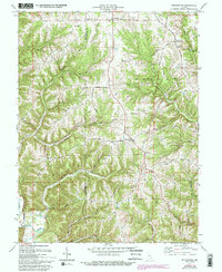
1971 Map of Bennington
USGS Topo · Published 1993About this map
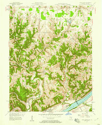
Pleasant and Bennington serve as the primary hubs in this corner of Switzerland County during the early 1970s. The landscape is defined by its dramatic ridges and creek forks, with Greenbrier Ridge and Smith Ridge dictating the placement of rural roads and homesteads. Local heritage is deeply rooted in the numerous country churches and burial grounds that dot the upland terrain, including Horse Chapel, Caledonia Ch, and the Zion Cem. Transport history is represented by the Treaty Line Road, which follows a significant boundary through the township. The drainage patterns of Brushy Fork and Kentuck Creek carve out deep hollows like Sugar Hollow, creating a complex network of natural corridors that have historically influenced the settlement patterns of Shelby and Milton townships.
Find a feature on this map
40 named features on this map. Tap any name to fly to it.
Don’t see what you’re looking for? This feature index may not catch every label — zoom into the map to look around manually.
Map Details
Editions of this 1971 Bennington Map
4 editions found
Other maps of this area

1943 · Vevay North
USGS Topo · 1:24,000

1943 · Brooksburg
USGS Topo · 1:24,000

1943 · Vevay South
USGS Topo · 1:24,000

1952 · Vevay South
USGS Topo · 1:24,000

1953 · Carrollton
USGS Topo · 1:24,000

1953 · Madison East
USGS Topo · 1:24,000

1956 · Bennington
USGS Topo · 1:24,000

1956 · Canaan
USGS Topo · 1:24,000

1956 · Louisville
USGS Topo · 1:250,000
1957 · Vevay North
USGS Topo · 1:24,000