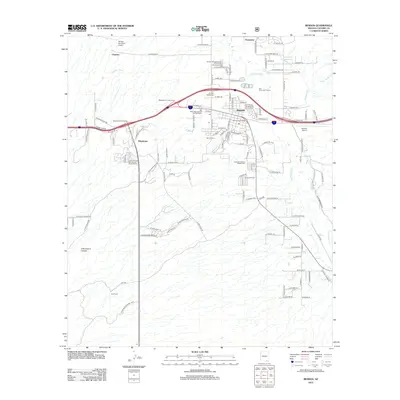
2012 Map of Benson
USGS Topo · Published 2012About this map
The San Pedro River corridor serves as the primary artery for settlement and commerce in this portion of Cochise County. The city of Benson is the focal point, positioned where major transportation interchanges meet the river's path, supported by local infrastructure like the Benson Municipal Airport and San Pedro Golf Course. To the north, the community of Pomerene and the Pomerene Canal illustrate the importance of water management in this arid environment, while the tiny settlement of Chamiso and the Post Ranch to the southwest reflect the more dispersed ranching and rural character of the land. Significant local history is preserved at the Benson Cem and Cochise Gardens of Rest Cem. Southward, the terrain transitions into the protected slopes of the Coronado National Frst, providing a sharp contrast to the developed corridors of Whetstone and the various recreational vehicle resorts clustered along the highway.
Find a feature on this map
120 named features on this map. Tap any name to fly to it.
Don’t see what you’re looking for? This feature index may not catch every label — zoom into the map to look around manually.
Map Details
Editions of this 2012 Benson Map
This is the sole edition of this map. No revisions or reprints were ever made.
Other maps of this area

1915 · Benson
USGS Topo · 1:125,000

1922 · St. David
USGS Topo · 1:62,500

1926 · Whetstone
USGS Topo · 1:62,500

1943 · Benson
USGS Topo · 1:125,000

1943 · Dragoon
USGS Topo · 1:62,500

1945 · Happy Valley
USGS Topo · 1:62,500

1956 · Nogales
USGS Topo · 1:250,000

1956 · Tucson
USGS Topo · 1:250,000

1958 · Nogales
USGS Topo · 1:250,000

1958 · Tucson
USGS Topo · 1:250,000