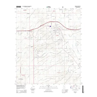
2014 Map of Benson
USGS Topo · Published 2014About this map
The San Pedro River serves as the primary artery through this high-desert landscape, defining the geographic orientation of the San Pedro Valley. The city of Benson occupies the center of the survey, where local street grids like W 4th St and E McNeil St meet the regional transport corridors. To the north, the agricultural legacy of the valley is evident along the Pomerene Canal near the settlement of Pomerene, while the southwestern reaches are dominated by the rugged slopes of the Coronado National Forest. This mapping records the modern footprint of these desert communities, including civic landmarks like the Benson Cem and Cochise Gardens of Rest Cem. Topographic features such as Cottonwood Canyon and Cadillac Wash show the complex drainage patterns that shape the terrain surrounding the Benson Municipal Airport.
Find a feature on this map
89 named features on this map. Tap any name to fly to it.
Don’t see what you’re looking for? This feature index may not catch every label — zoom into the map to look around manually.
Map Details
Editions of this 2014 Benson Map
This is the sole edition of this map. No revisions or reprints were ever made.
Other maps of this area

1915 · Benson
USGS Topo · 1:125,000

1922 · St. David
USGS Topo · 1:62,500

1926 · Whetstone
USGS Topo · 1:62,500

1943 · Benson
USGS Topo · 1:125,000

1943 · Dragoon
USGS Topo · 1:62,500

1945 · Happy Valley
USGS Topo · 1:62,500

1956 · Nogales
USGS Topo · 1:250,000

1956 · Tucson
USGS Topo · 1:250,000

1958 · Nogales
USGS Topo · 1:250,000

1958 · Tucson
USGS Topo · 1:250,000