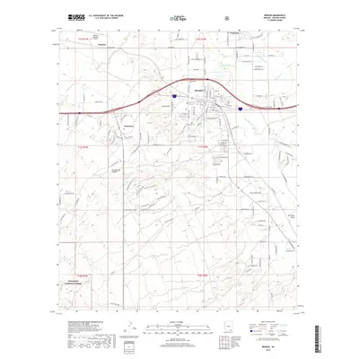
2018 Map of Benson
USGS Topo · Published 2018About this map
The Benson city center serves as the focal point of this late 2010s survey, situated where the high desert meets the fertile San Pedro Valley. This corridor has long been a vital transportation artery, evidenced here by the dense street grid of the old town and the expansive Benson Municipal Airport to the northwest. The presence of the Pomerene Canal and the winding San Pedro River highlights the essential water infrastructure required for life in this arid climate, while the nearby Pomerene settlement and Whetstone community show the continued expansion of residential areas outside the historic core. Local history is anchored by the Benson Cem and Cochise Gardens of Rest Cem, while the southwestern corner of the quadrangle reaches into the protected lands of the Coronado National Forest, illustrating the transition from urban development to preserved wilderness.
Find a feature on this map
87 named features on this map. Tap any name to fly to it.
Don’t see what you’re looking for? This feature index may not catch every label — zoom into the map to look around manually.
Map Details
Editions of this 2018 Benson Map
This is the sole edition of this map. No revisions or reprints were ever made.
Other maps of this area

1915 · Benson
USGS Topo · 1:125,000

1922 · St. David
USGS Topo · 1:62,500

1926 · Whetstone
USGS Topo · 1:62,500

1943 · Benson
USGS Topo · 1:125,000

1943 · Dragoon
USGS Topo · 1:62,500

1945 · Happy Valley
USGS Topo · 1:62,500

1956 · Nogales
USGS Topo · 1:250,000

1956 · Tucson
USGS Topo · 1:250,000

1958 · Nogales
USGS Topo · 1:250,000

1958 · Tucson
USGS Topo · 1:250,000