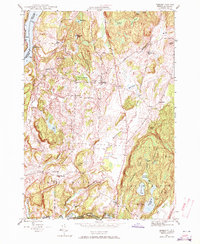
1946 Map of Benson
USGS Topo · Published 1972About this map
Benson serves as the central hub of this 1946 landscape, situated at a junction of rural routes like Lake Road and The Crossroad. The geography is defined by the proximity to Lake Champlain and the meandering Poultney River, which forms the border between New York and Vermont. The map reveals a highly decentralized educational network, with numerous small schoolhouses such as Aiken Sch, Bump Sch, and Turnpike Sch serving the scattered farmsteads. Industrial and infrastructure markers include Howard Dam and the Carver Falls Dam, reflecting the harnessed water power of the area. The prevalence of family and street-named burial grounds, including Carter Street Cem and Hackett Cem, provides a detailed record of early settlement patterns and genealogical data for the Rutland County region.
Find a feature on this map
58 named features on this map. Tap any name to fly to it.
Don’t see what you’re looking for? This feature index may not catch every label — zoom into the map to look around manually.
Map Details
Editions of this 1946 Benson Map
3 editions found
Other maps of this area

1893 · Whitehall
USGS Topo · 1:62,500

1894 · Ticonderoga
USGS Topo · 1:62,500

1895 · Whitehall
USGS Topo · 1:62,500

1895 · Castleton
USGS Topo · 1:62,500

1896 · Ticonderoga
USGS Topo · 1:62,500

1897 · Castleton
USGS Topo · 1:62,500

1898 · Whitehall
USGS Topo · 1:62,500

1902 · Whitehall
USGS Topo · 1:62,500

1902 · Ticonderoga
USGS Topo · 1:62,500

1902 · Brandon
USGS Topo · 1:62,500