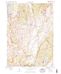
1946 Map of Benson
USGS Topo · Published 1976About this map
The Hubbardton River and Poultney River drain this corner of Rutland County shortly after the war, where the agricultural landscape is dotted with small rural schools and local burial grounds. The village of Benson serves as a central hub, connected to the western shores of Lake Champlain at Benson Landing via the Sunset Lake Road. This 1946 survey illustrates a community still deeply tied to its geography, with family-named landmarks like Wilcox Hill and Forbes Hill rising above the marshy lowlands of Cranberry Swamp and Walker Swamp. Along the southern boundary, the Poultney River powers industrial infrastructure at the Carver Falls Dam, while the Delaware And Hudson RR skirts the western edge near Putnam. Genealogists will find several distinct cemeteries preserved here, including Carter Street Cem and Hitchcock Cem, which mark the settlement patterns of West Haven and its surroundings.
Find a feature on this map
62 named features on this map. Tap any name to fly to it.
Don’t see what you’re looking for? This feature index may not catch every label — zoom into the map to look around manually.
Map Details
Editions of this 1946 Benson Map
3 editions found
Other maps of this area

1893 · Whitehall
USGS Topo · 1:62,500

1894 · Ticonderoga
USGS Topo · 1:62,500

1895 · Whitehall
USGS Topo · 1:62,500

1895 · Castleton
USGS Topo · 1:62,500

1896 · Ticonderoga
USGS Topo · 1:62,500

1897 · Castleton
USGS Topo · 1:62,500

1898 · Whitehall
USGS Topo · 1:62,500

1902 · Whitehall
USGS Topo · 1:62,500

1902 · Ticonderoga
USGS Topo · 1:62,500

1902 · Brandon
USGS Topo · 1:62,500