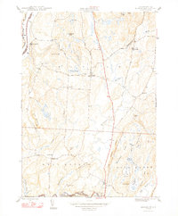
1948 Map of Benson
USGS Topo · Published 1948About this map
The Hubbardton River and Champlain Lake anchor this agricultural and marshy landscape along the Vermont-New York border just after the Second World War. The settlement of Benson serves as a central hub, connected by a network of rural routes like Old Stage Road and The Crossroad. To the west, Benson Landing marks a historic point of transit on the lake, while the village of West Haven sits further south near the winding path of Coggman Creek.
Find a feature on this map
65 named features on this map. Tap any name to fly to it.
Don’t see what you’re looking for? This feature index may not catch every label — zoom into the map to look around manually.
Map Details
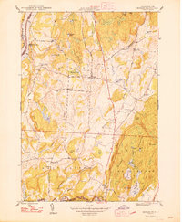
Editions of this 1948 Benson Map
2 editions found
Other maps of this area

1893 · Whitehall
USGS Topo · 1:62,500

1894 · Ticonderoga
USGS Topo · 1:62,500

1895 · Whitehall
USGS Topo · 1:62,500

1895 · Castleton
USGS Topo · 1:62,500

1896 · Ticonderoga
USGS Topo · 1:62,500

1897 · Castleton
USGS Topo · 1:62,500

1898 · Whitehall
USGS Topo · 1:62,500

1902 · Whitehall
USGS Topo · 1:62,500

1902 · Ticonderoga
USGS Topo · 1:62,500

1902 · Brandon
USGS Topo · 1:62,500