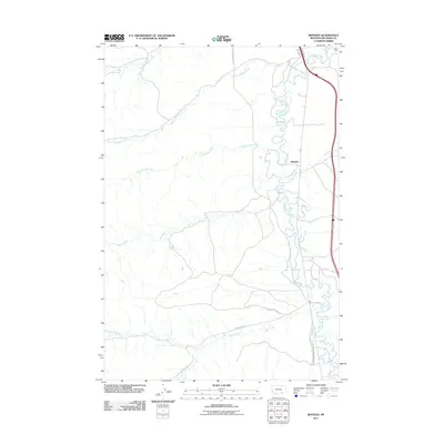
2011 Map of Benteen
USGS Topo · Published 2011About this map
The Little Bighorn River meanders through the eastern corridor of this landscape, defining the character of the Benteen area. This 2011 survey documents a river valley shaped by hydraulic engineering, evidenced by the Lodge Grass Canal Number One and the Reno Canal, which divert water for agriculture in an otherwise arid drainage basin. The ruggedness of the terrain is further delineated by a network of seasonal watercourses, including Shoulder Blade Creek, Bear-in-Middle Creek, and Mud Springs Creek, all flowing toward the primary river valley.
Find a feature on this map
16 named features on this map. Tap any name to fly to it.
Don’t see what you’re looking for? This feature index may not catch every label — zoom into the map to look around manually.
Map Details
Editions of this 2011 Benteen Map
This is the sole edition of this map. No revisions or reprints were ever made.
Other maps of this area

1894 · Rosebud
USGS Topo · 1:125,000

1894 · St. Xavier
USGS Topo · 1:125,000

1894 · Fort Custer
USGS Topo · 1:125,000

1901 · Rosebud
USGS Topo · 1:125,000

1901 · St. Xavier
USGS Topo · 1:125,000

1954 · Hardin
USGS Topo · 1:250,000

1957 · Hardin
USGS Topo · 1:250,000

1958 · Hardin
USGS Topo · 1:250,000

1960 · Schick Ranch
USGS Topo · 1:24,000

1960 · St Xavier NE
USGS Topo · 1:24,000